A Change of Scenery
Plus, a monument stretches out, pupfish bounce back, a wildflower photo contest, an accidentally historic bird sighting, new trails, and lots more
howdy
If you’ve been reading this newsletter for a while, you may have picked up a bit on the fact that I’ve really had to get used to the nuances of hiking in the Pacific Northwest after learning to hike (and becoming very familiar with) the landscape around Southern California.
It hasn’t always been easy—I miss my vistas and my chaparral, and I can’t tell you how many trails I hiked last year that were just these long green tunnels of the same six plants over and over again—but there really is a lot to love here.
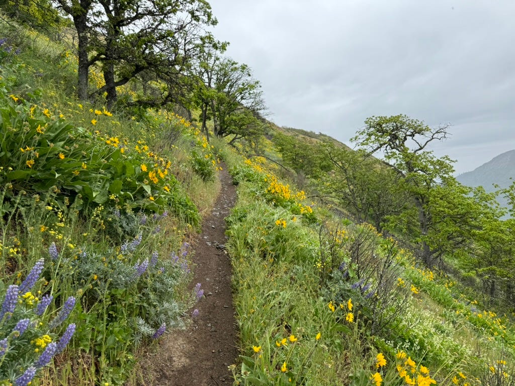
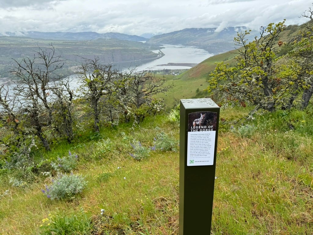
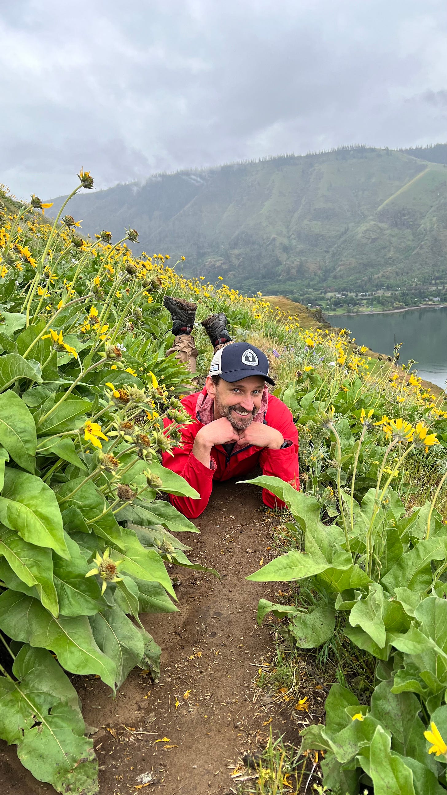
I was happy to be able enjoy a really exceptional trail in the Columbia River Gorge recently. Not only did we brush off a prediction of rain to enjoy a hike with really just a few bouts of mist, but we also got to enjoy some of the Gorge’s spring wildflower shows and verdant meadows pretty much all to ourselves.
The Lyle Cherry Orchard Loop is definitely not a “secret” hike by any means (I have a lot of thoughts on so-called ‘secret hikes’ but I’ll save them for later), but it was my first time exploring this area and—unlike a lot of hikes nearby—it offered up a few different types of terrain to enjoy. We had dense, dripping forests (with plenty of poison oak to dodge), wide, grassy meadows, steep slopes covered in wildflowers, terrific views of the Columbia River Gorge, and a surprisingly spooky oak forest where the trail turned and bobbed over bumps on the ridge like a little roller coaster.
The trail has had a lot of work done recently by the Friends of the Columbia Gorge, and I think that definitely helped, too. The trail signs there were some of the cleanest I have ever seen in my life (and of course I found out later that they were literally installed the week prior), but I also think this particular trail was a great combination of good timing, decent weather, and a location in a transition zone between the wet western Columbia Gorge and the drier, more high-desert-y eastern Columbia Gorge—which definitely lent the trail its sense of variety.
I’ll have to keep those things in mind while I’m picking my next trails … or, hey, maybe I’m finally getting to appreciate this new landscape!
Oh yeah, and I still did the dumb summit selfie thing for y’all. I said I would do it, and I’m doing it.
Modern Hiking
Good stuff from the Modern Hiker site
Well, I will admit I have had a sizable backlog of trails to add to the site. I’ve been chasing a few freelance gigs and looking for additional work, as well as focusing on a poetry class and submitting to a few conferences, and all of that’s been taking a little more time away from Modern Hiker than I’d prefer. Also, if you’re reading this on the free subscriber timeline, you can do me a serious solid here by bumping up to a paid subscription—I’ll get to spend more time on the site and newsletter instead of wondering which AI-powered demon is rejecting my resume from positions I’m qualified for! Everyone wins!
Anyway, thanks again to you fine, upstanding heroes who are already paid subscribers. You get to read this the day I publish, and I’ve also heard you’re all very attractive and successful, too.
Some of the new trails added to the site lately, in addition to Lyle Cherry Orchard, include the historic route to Mount Emma and Old Mount Emma in the San Gabriel Mountains, a beautiful loop near Zuma Canyon in the Santa Monica Mountains, and a stunning, tree-lined loop in a lovely regional park in the Santa Cruz Mountains.
The Big Story
Something to talk about
Well, It Finally Happened
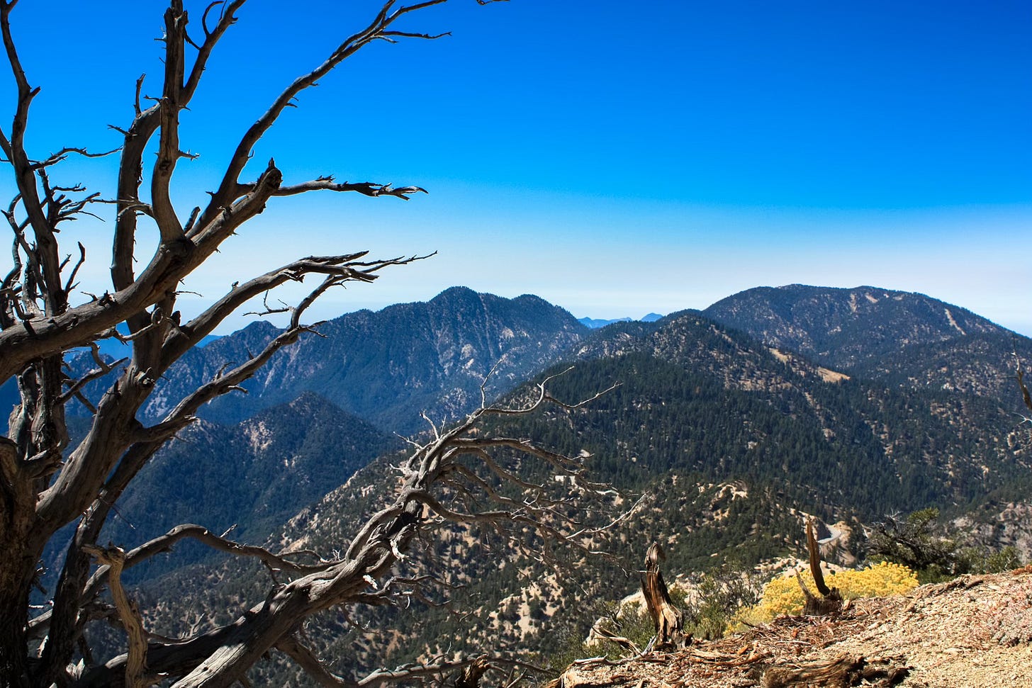
A few weeks back, I told you about some rumblings and rumors that President Joe Biden was about to use the Antiquities Act to expand the San Gabriel Mountains National Monument near Los Angeles … and also that basically I’d eat my hat if it happened that weekend like people were saying it would.
Well, I was right about it not happening then, but it did happen! On Thursday, May 2, the President added about 120,000 acres to the national monument from existing Forest Service land, basically correcting the weird chunk of excluded land from monument’s original 2014 boundaries that left out some of the most unique, most interesting, and most-visited areas of the mountain range.
Previous legislative efforts to expand the monument had also included a new National Recreation Area near the foothills of the San Gabriels that would have snaked along a few of the rivers into the San Gabriel Valley, but the Antiquities Act only allows for national monuments, so those recreation area plans will likely still have to make their way through Congress. Good luck!
The best news, though, is the announcement that the newly expanded monument will also get an investment for more resources and staff, which have been sorely needed for a long, long time. As part of the new funding, the San Gabriel Mountains National Monument will receive $1 million from a mix of private philanthropists and various state and federal agencies, as well as support from the Tiuvac’a’ai’ Tribal Conservation Corps and $2.3 million from the Great American Outdoors Act. The announcement notes this funding will go toward additional field rangers, interpretive positions, and visitor engagement staff—again, all of which are badly, badly needed.
In addition to—let’s just say it again—fixing the original boundaries of the San Gabriel Mountains National Monument, the President also expanded the Berryessa Snow Mountain National Monument just north of Sacramento to include Molok Luyuk, sacred land for the Yocha Dehe Wintun Nation. So … not a bad week!
Wildlife Crossing
Wildlife and the Outdoors
Beach Photographer Accidentally Snags Shot of Rare Bird
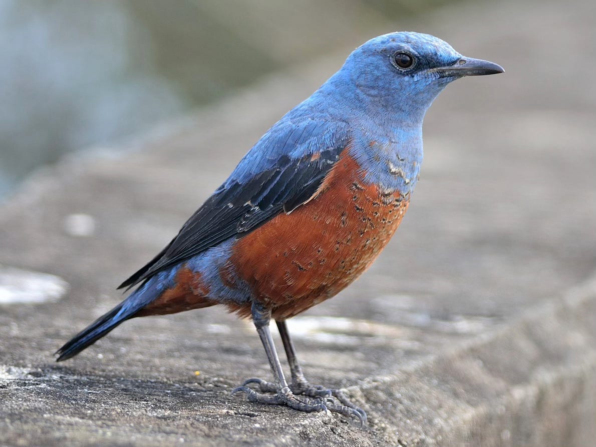
Well, this story will make your birding friends jealous. Michael Sanchez was prepping his camera to take some sunrise beach shots at Oregon’s Hug Point when he noticed a playful small bird hopping around the sand. He snapped a few photos and then went back to the sunrise. He posted his photos to social media, and a friend freaked out because he was pretty sure Sanchez had a photo of a blue rock-thrush, which is native to east Asia.
The species had only been spotted in this region once before—in 1997—but the American Birding Association had rejected that sighting as official (this article in The Guardian doesn’t say why, but maybe due to lack of good photo evidence?). Now birding groups are working to help Sanchez confirm this sighting with the Association, which would make him the first person to capture images of this bird in North America.
Which just goes to show you—if you see something on your next hike that looks a little unusual, definitely snag a geotagged photo.
A Pupfish Party
One of my favorite aspects of the various Great Basin deserts is that many of them have populations of tiny fish—some of the last remnants of when this area consisted of huge inland lakes and streams. Long story short, those lush wetlands turned to deserts, and as one species of pupfish had to retreat to various tiny corners scattered all over, each population evolved its own adaptation and became a separate species. So you have some like the Salt Creek Pupfish that can survive extremely saline waters on the floor of Death Valley, and others like the Devil’s Hole Pupfish that basically survive on a single rock shelf in a hot spring in a Nevada exclave of Death Valley National Park.
All the pupfish are critically endangered, but right now the Devil’s Hole Pupfish look like they’re going (relatively) gangbusters. National Parks Traveler reports the current spring population at Devil’s Hole are at a 25-year high of 191 (the all-time low was just 35 fish in 2013).
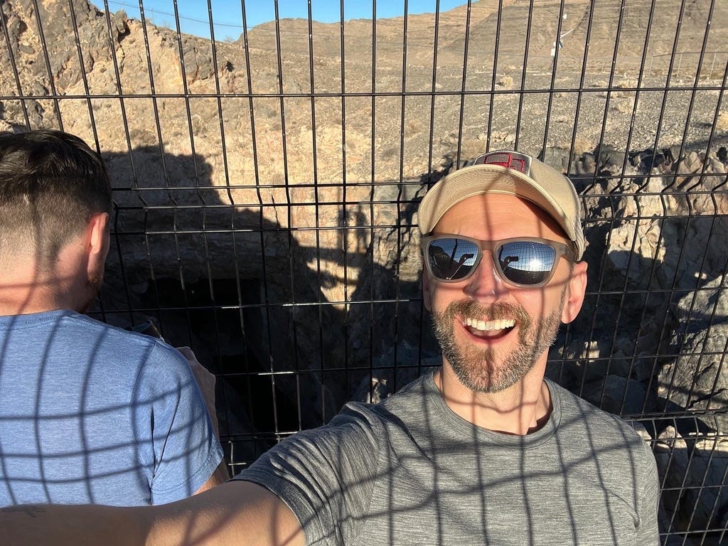
I have always been fascinated by the pupfish, and a few years back on a roadtrip in a Roadsurfer van, we took a detour to view the Devil’s Hole pupfish site. Could we see anything? No. Was it still super cool? Absolutely.
Leafing Out
Plants!
Get in on CalFlora’s 10th Annual Photo Contest
Calfora—really your go-to source for information and observations on plants in the Golden State—has launched its tenth annual photo contest for the month of May. Upload your best California plant photos to the site this month or use Calflora’s smartphone app Calflora Observer Pro (iOS and Android), vote by liking photos in the photo pool, and you could win “the traditional fame and glory” from your fellow plant nerds (hey, it’s a nonprofit). OK, they also say there’s a prize, but they don’t really specify what it is. But again—remember—nonprofit here.
Photos should be as close to the original as possible—only cropping, rotation, and basic adjustments to brightness contrast and white balance are allowed.
One More Thing
Oh yeah, before I go …
This is not outdoor related at all, but I found this feature piece on the band Khruangbin (UNLOCKED) in the New York Times to be exceptionally engaging writing, and ultimately a fascinating look at creativity in general and—specifically—how individuals in a group can have intangible contributions to the whole.
That’s all for now. Until next time,
Happy Trails.



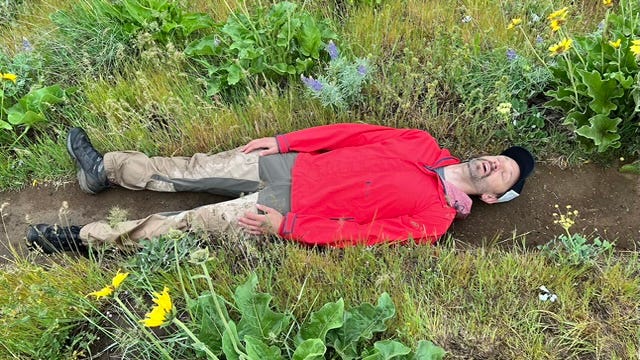


(🤔 So, is that guy doing savasana in the middle of the trail or should I call SAR?)
Really enjoyed this week’s newsletter—Thanks!